Key Lakefront Appraisal Factors in Murphy, NC
November 6, 2025
November 6, 2025
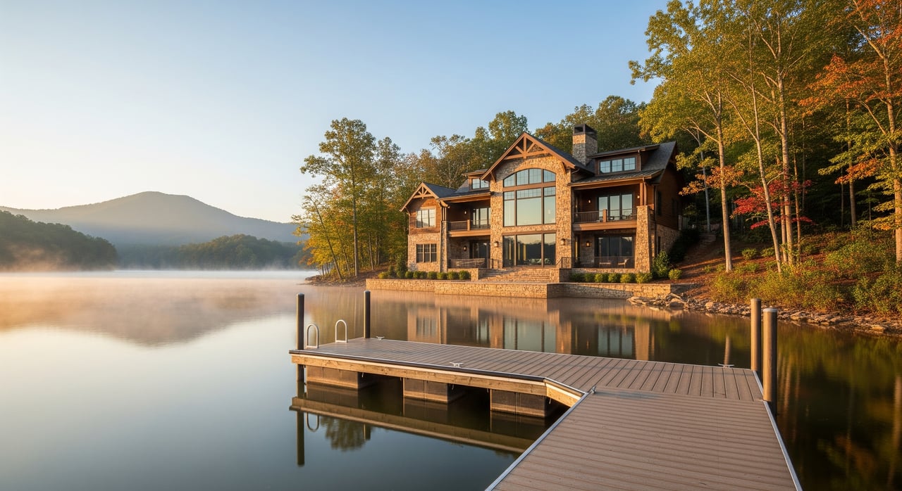
Buying or selling on the water in Murphy can feel exciting and a little uncertain, especially when you hear how much a dock or view can change an appraisal. You want a fair value and a smooth loan process, and you also want to know which lake features truly move the needle. You will learn what appraisers look for, why permits and depth matter, how adjustments are made, and what to prepare so your appraisal reflects the real value of your shoreline. Let’s dive in.
Appraisers in Cherokee County follow established standards to develop a credible opinion of market value using verified facts and local comparable sales. For lakefront homes, the sales comparison approach is usually the main method because buyers respond to features they can see and use, like a permitted dock, deep water, or an open view.
Lenders expect appraisals to be supported by verifiable comparable sales and clear documentation for special features that affect value. That makes your permits, surveys, photos, and flood information more than paperwork. They help the appraiser quantify what your lake access is worth in today’s market.
Waterfront use in Murphy is shaped by multiple layers of oversight that may include county offices, state environmental agencies, and the lake’s managing authority. A dock that exists but is not authorized can become a liability and may not contribute full value. If a feature must be removed or cannot be legally replaced, the appraiser will consider that risk and may adjust downward.
Because lakefront sales are fewer than typical in-town sales, appraisers may need to expand the search in time or distance while matching key waterfront traits. Strong comps share similar frontage length, dock status, view quality, shoreline conditions, and access. Solid documentation helps your property line up well with the best available sales.
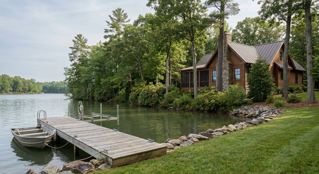
Appraisers record whether there is a dock, the type and size, condition, access, and the permit or authorization details. A legally permitted, well-built dock increases utility for boating and swimming, which usually boosts marketability. If a dock lacks proper authorization, is expired, or must be removed, the property can lose the dock premium and may face a downward adjustment.
What helps: Provide a copy of the dock permit or written confirmation from the managing authority, plus clear photos and any inspection reports. If you suspect a permit issue, contact the issuing agency before an appraisal to understand options.
Depth at the dock and seasonal water levels affect how you can use the property. Deeper, navigable water near the dock is more useful for a range of boats and is often preferred by buyers. Shallow approach, rock hazards, or seasonal drawdown that limits docking reduce utility and appeal.
What helps: Share depth measurements at the end of the dock, any bathymetric data, written notes on seasonal fluctuations, and comparable sales with similar depth.
Appraisers look at slope to the water, evidence of erosion, and whether the bank is stabilized or needs work. A gentle, usable shoreline with stable banks supports recreation and can lower future maintenance. Active erosion or a bulkhead that needs near-term replacement raises cost risk and can lead to a downward adjustment.
What helps: Provide dated shoreline photos, permits for stabilization, and recent repair estimates or invoices. This documentation helps the appraiser separate a cosmetic issue from a major stability problem.
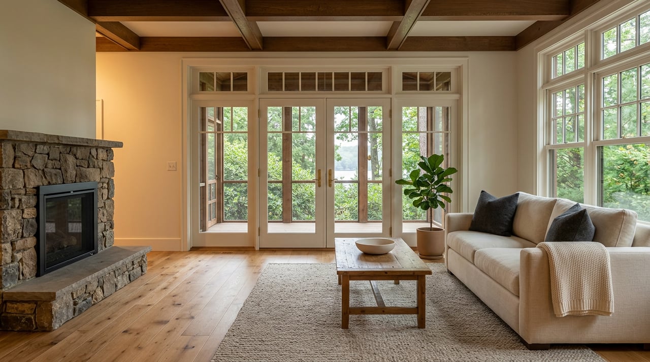
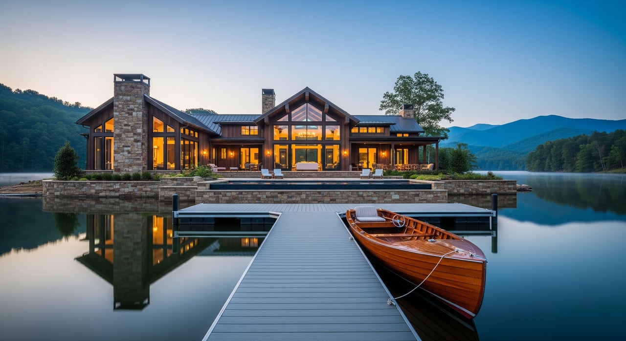
Unobstructed long-lake views and orientation toward open water typically command a premium relative to partial or treed views. Privacy, sightlines from main living areas, and seasonal changes also matter.
What helps: Include photos from primary rooms and outdoor spaces in both leaf-on and leaf-off seasons. Note view corridors, privacy, and any recorded restrictions that protect or limit tree clearing.
Linear feet of frontage is a common value driver, but not all frontage is equally useful. Appraisers differentiate between usable shoreline and sections that are steep or inaccessible. Easy access paths and safe stairs add practical utility.
What helps: Provide a current survey showing measured frontage and the location of improvements. If your deed includes riparian rights language, include that page in your packet.
FEMA flood zone, base flood elevation, and the home’s foundation height influence risk, insurance, and lender requirements. A home in a high-risk flood zone can carry higher costs and tighter lending conditions, which can reduce value. Elevated homes with documentation that shows limited risk can help avoid large negative adjustments.
What helps: Share the elevation certificate, flood zone determination printout, and current flood insurance declarations if applicable.
Private, deeded docking tends to be most valuable. Community or off-site access can be useful but generally contributes less than a private dock at the property. Nearby public ramps and marina services can add convenience, especially for guests and maintenance.
What helps: Include HOA or community documents that confirm access rights, any marina slip agreements, and a simple map showing distance to public facilities.
Restrictions can shape highest and best use. Rules that limit docks, boat types, or short-term rentals can narrow your buyer pool. Conservation easements may limit development but can appeal to buyers who value protected views and natural character.
What helps: Provide recorded covenants, easements, or shoreline overlays, along with any correspondence about approvals or limitations.
When the market provides good examples, appraisers use paired sales that are similar except for one feature, such as dock presence or view quality. That comparison helps isolate a reasonable adjustment for the feature in question.
Some items can be adjusted with numbers, like price per linear foot of usable frontage or dock size. Others, like view quality or restrictive covenants, require qualitative judgment that is backed by market evidence and clear notes.
A complete packet helps the appraiser verify what makes your property valuable and reduces the chance of conservative assumptions.
If you want a second set of eyes on your documents or need help prioritizing pre-appraisal tasks, reach out for tailored guidance. A little preparation can support a stronger valuation and a smoother closing.
Ready to talk through your lakefront goals in Murphy or nearby Western North Carolina? Request a Free Home Valuation or Schedule a Consultation with Unknown Company.


As a full-time Real Estate Agent, wife, mom, and barrel racer, Karyn balances her dynamic life with a steady commitment to her clients. With Karyn, you get more than an agent—you get an advocate.